




Key takeaways
- The Salkantay Trail to Machu Picchu runs roughly 72 km across 4 to 5 days, with the Salkantay Pass near 4,600 m as its highest point.
- Machu Picchu sits at 2,430 m above sea level, a UNESCO World Heritage Site inscribed in 1983 (UNESCO).
- Altitude illness can start at sleeping elevations of 2,450 m or higher, so the whole trek sits in the risk zone (CDC).
- The dry season from May to September offers the most reliable hiking weather and clearer mountain views.
- Most hikers finish at Aguas Calientes, then ride the bus or walk up to the Machu Picchu entrance.
The Salkantay Trail to Machu Picchu is a 4 to 5 day high-mountain trek of roughly 72 km that crosses a snow-flanked pass near 4,600 m before dropping into cloud forest and finishing at the ancient citadel. Expect cold mornings at altitude, long walking days, turquoise glacial lakes, and a steady change of scenery from icy peaks to jungle. This guide walks through the route, the landmarks, the altitude, the weather, and how you actually reach Machu Picchu at the end.
What Does the Salkantay Trail Route Look Like?
The Salkantay Trail to Machu Picchu is a point-to-point trek that starts in the highlands outside Cusco and ends at the gateway town below the citadel. It covers roughly 72 km on foot across four or five days, passing beneath Salkantay Mountain, the highest peak in the Vilcabamba range at about 6,271 m.
Most groups drive from Cusco to the Mollepata area, then walk toward the high camp at Soraypampa. From there the trail climbs to the Salkantay Pass, descends through cloud forest toward Santa Teresa, and follows the valley to Aguas Calientes. The route needs no separate trek permit, which makes it a flexible alternative to the permit-capped classic Inca Trail. If you want a day-by-day breakdown of a similar Andean itinerary, see our Salkantay Trek: The Ultimate Alternative Route guide.
Why do so many hikers pick this path? It trades crowds and booking limits for raw scenery and a sense of space.
Which Landmarks and Viewpoints Stand Out?
The signature sights on the Salkantay Trail are Humantay Lake, the Salkantay Pass itself, and the cloud forest descent toward the jungle. Each marks a clear shift in the landscape, and together they give the trek its range from ice to green valley.
Humantay Lake is a glacial lake with striking turquoise water, reached on a side climb near the first high camp. The Salkantay Pass is the emotional high point, a wind-scoured saddle with the glaciers of Salkantay Mountain looming close. Lower down, hikers pass coffee farms, waterfalls, and small ruins with distant views toward Machu Picchu.
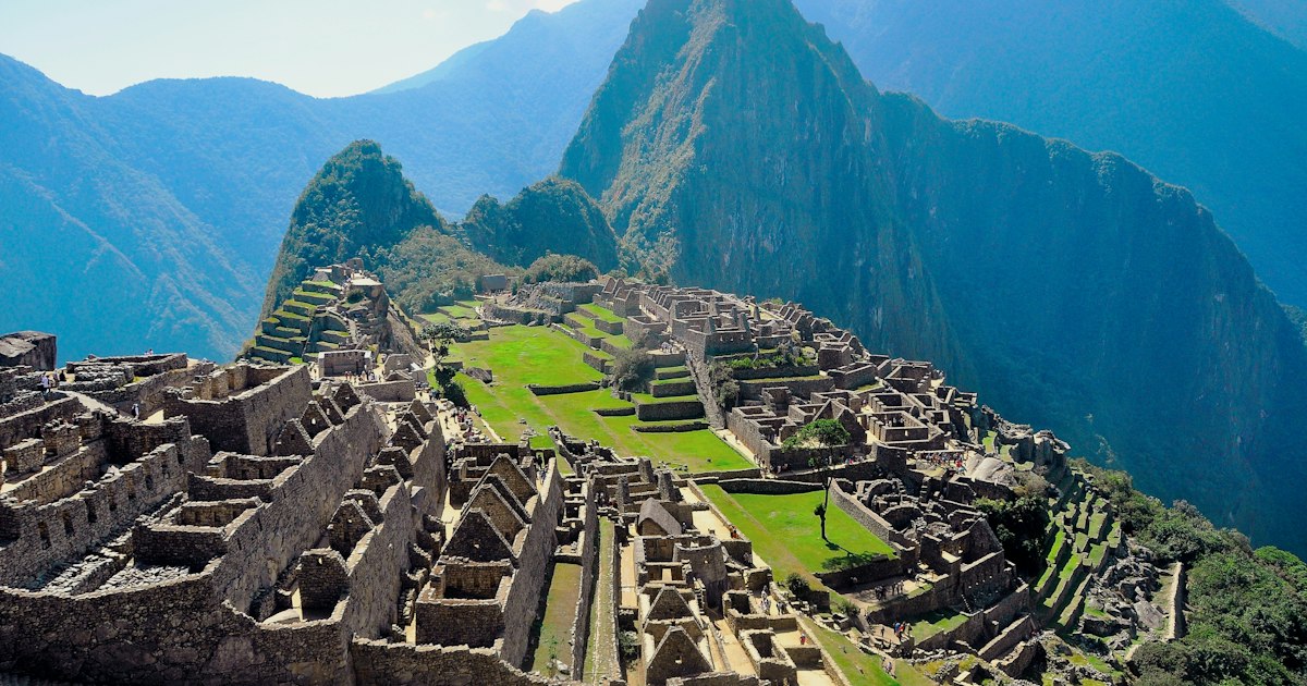
At the end of the walk, Machu Picchu itself is the reward. The site sits at 2,430 m in the middle of a tropical mountain forest and has been a UNESCO World Heritage Site since 1983 (UNESCO World Heritage Centre). Seeing it after days on the trail lands differently than arriving fresh off a train.
How Hard Is the Altitude Profile Day by Day?
Altitude is the defining challenge of the Salkantay Trail to Machu Picchu, since the entire route sits in the elevation band where altitude illness becomes a real risk. The U.S. CDC notes that any unacclimatized traveler reaching a sleeping altitude of 2,450 m or higher is at risk for altitude illness, with symptoms often starting 2 to 12 hours after arrival (CDC Yellow Book).
The hardest day is the pass crossing. You climb from the high camp to the Salkantay Pass near 4,600 m, usually in cold pre-dawn air, then make a long knee-testing descent. The pass is higher than the top of the classic Inca Trail, so acclimatizing in Cusco for two or three days first is wise.
Daily shape of the trek:
- Day 1: Steady climb to the first high camp, with an optional side hike to Humantay Lake.
- Day 2: The pass crossing and a long descent into warmer, greener terrain.
- Day 3: Gentler valley walking through cloud forest toward Santa Teresa.
- Day 4: Travel along the river valley to Aguas Calientes below Machu Picchu.
Hydrate, walk at a slow steady pace, and tell your guide early if a headache or nausea sets in. Those simple habits prevent most altitude trouble before it grows.
When Is the Best Time to Hike the Salkantay Trail?
The best window for the Salkantay Trail to Machu Picchu is the dry season from May through September, when skies are clearer and trails are firmer. Rain is far less likely, the high pass is less prone to heavy snow, and the mountain views that make this trek famous show up most reliably.
The wet season from November through March brings mud, slick descents, and a real chance of clouds hiding Salkantay Mountain. Some operators pause trips in the wettest weeks of February. The shoulder months of April and October can be a sweet spot, with fewer hikers and often decent weather.
Temperatures swing hard with elevation. Expect near-freezing nights at the high camp and the pass, then warm, humid afternoons in the cloud forest. Pack layers you can add and shed fast, plus solid rain gear whatever the month.
How Do You Reach Machu Picchu at the End?
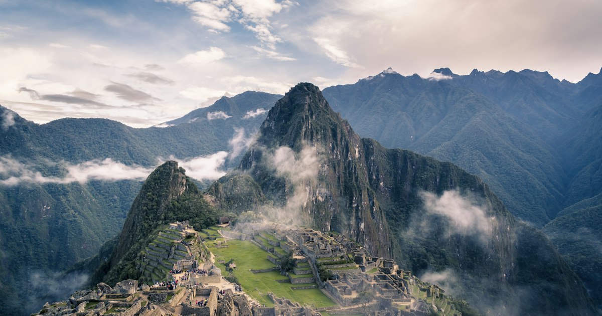
The Salkantay Trail finishes in Aguas Calientes, the valley town directly below Machu Picchu, and from there you take a short bus ride or a steep walk up to the citadel entrance. Nearly everyone sleeps in Aguas Calientes the final night, then enters Machu Picchu early the next morning.
Two ways up the mountain:
- Bus: A series of switchbacks carries you from town to the gate in under half an hour. It saves your legs for walking the ruins.
- On foot: A stone stairway climbs through forest to the same gate, taking most hikers well over an hour.
You need a timed entrance ticket for Machu Picchu, booked in advance and tied to a specific circuit and entry window. In the busy June to August stretch, slots sell out, so reserve early. Incajungletrail builds these tickets and the final logistics into its guided Salkantay departures, so the paperwork is handled before you arrive.
Standing at the citadel after days of walking, the climb through ice and jungle finally makes sense. Book your dry-season Salkantay departure now, give yourself two acclimatization days in Cusco first, and you will meet the mountain ready.
Frequently asked questions
How many days does the Salkantay Trail to Machu Picchu take?
Most itineraries run 4 to 5 days. Four days is the common choice, while five days adds slower acclimatization and more time at viewpoints like Humantay Lake.
How high is the Salkantay Pass?
The pass sits near 4,600 m, the highest point of the route. You cross it on the second day, usually in the cold early morning hours before descending into the cloud forest.
Do I need a permit for the Salkantay Trail?
No separate trek permit is required for the Salkantay route, unlike the classic Inca Trail. You still need a timed Machu Picchu entrance ticket, which sells out in peak months.
Is the Salkantay Trek harder than the Inca Trail?
The Salkantay Pass is higher than the Inca Trail's top pass, so altitude is the main challenge. Daily distances are long but the trail is non-technical and open to fit hikers.
What is the best month to hike the Salkantay Trail?
May through September, the dry season, gives the most stable weather and the clearest mountain views. June to August is busiest, so book entrance tickets well ahead.